B.C. Ferries passengers may not know they’re also aboard a mobile ocean observatory.
Three vessels that cross the Strait of Georgia have been outfitted with instruments for collecting ocean and atmospheric information, through a partnership with Ocean Networks Canada.
Scientists are using the data to monitor the strait’s habitat health, which has implications for everything from micro-organisms to larger species such as salmon and orcas.
“Now that we have all three [vessels], we cover a zig-zag through the Gulf Islands and across the strait, which gives us a very comprehensive view of the surface conditions,” said Richard Dewey, associate director for science services at Ocean Networks Canada, which is a University of Victoria initiative.
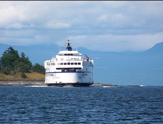
The Queen of Oak Bay is the latest vessel to have instruments installed on its hull to monitor surface conditions such as oxygen levels, temperature, salinity, turbidity, chlorophyll levels and organic matter. A weather station on the deck collects atmospheric data.
The Queen of Oak Bay travels between Horseshoe Bay in West Vancouver and Departure Bay in Nanaimo.
Similar systems were installed in 2014 on the Spirit of Vancouver Island, which travels between Swartz Bay and Tsawwassen, and in 2012 on the Queen of Alberni, which travels between Tsawwassen and Duke Point in Nanaimo.
The ferry monitors expand Ocean Network Canada’s existing network, which includes the VENUS underwater cabled ocean observatory.
But while VENUS monitors underwater, the ferry data is specific to the surface. That’s an important area of research, Dewey said, because it’s where fresh water from the Fraser River spills out into the ocean.
“It contributes significantly to the large-scale circulation and exchanges with the Pacific Ocean,” Dewey said.
The less dense fresh water tends to float at the surface, pushing salty water along the bottom.
“Understanding the river plume dynamics, as it spills out into the Strait of Georgia, is critical to our understanding of how the whole Salish Sea works.”
It’s also critical to understanding the marine habitat, since ocean nutrients and the species that depend on it are affected by the way the fresh water and salt water mix.
In addition to the freshwater plume, scientists are collecting information about springtime phytoplankton blooms, Dewey said.
Phytoplankton are at the base of the aquatic food chain, feeding zooplankton, which feed herring and salmon, which feed marine mammals like orcas.
The phytoplankton bloom is a healthy part of the ecosystem, Dewey said, and is separate from a large and unusual algae bloom on the west coast of Vancouver Island.
“We can monitor the timing and distribution of both of these processes with the ferries — both the plume and the blooms,” Dewey said.
The only other technique for monitoring the plume and the bloom is through satellite imagery, he said, but that depends on clear weather.
“The ferry system now lets us monitor that continuously over the year,” Dewey said.
The data collected by Ocean Networks Canada is available to the broader research community, not just UVic.
B.C. Ferries spokeswoman Deborah Marshall said the project does not affect operations.
“They approached us with the idea and it’s no cost to B.C. Ferries,” Marshall said. “We just thought it was a worthwhile project that we were happy to help out with.”


