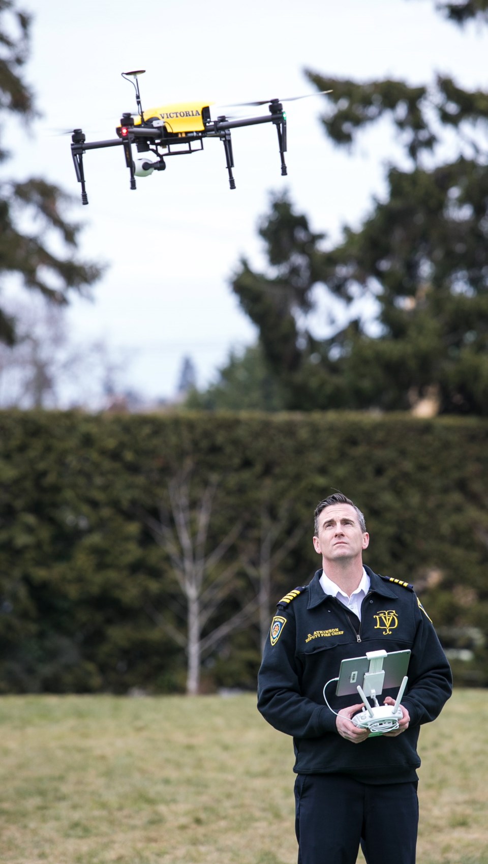
The Victoria Fire Department is adding drones to its emergency response tool kit, reflecting a trend among first responders.
The drones, also known as unmanned aerial vehicles, could be used in search-and-rescue missions, to pinpoint the location of a brush fire or to conduct rapid damage assessment after an earthquake, said Deputy Fire Chief Dan Atkinson.
If someone were missing in the water, for example, a drone could scan a large swatch of ocean more quickly and cheaply than a helicopter, Atkinson said. “The ability to home in on the area and determine where our resources are best staged is a huge benefit for us.”
Images captured by the drone can be broadcast in real time to the operator, via tablet or computer. The drone’s flight plan can be mapped out in advance through GPS or operated manually.
On Sunday, Victoria Fire hoisted the drone above Pandora Avenue, where protected bike lanes are being installed to capture before and after images. Atkinson said the bike lanes cause the department to change its emergency-response routes.
Atkinson said the drone can be provided to other city departments such as planning, engineering and parks, and be used regionally in an emergency.
The fire department purchased three drones, cameras and accessories for just under $20,000.
Use of drones has sparked privacy concerns, with some people raising the alarm about drones hovering near their windows.
Atkinson said the department will avoid capturing images of people’s faces or licence plates. The video will not be available publicly.
There will be early notification if the fire department plans to use a drone in a residential area, Atkinson said.
The Office of the Information and Privacy Commissioner of B.C. has raised concerns about the use of drones by law enforcement, specifically as a surveillance tool.
“Our understanding is that no police force in B.C. currently uses drones for routine [non-emergency] surveillance,” said Erin Beattie, a spokeswoman for the office.
Transport Canada prohibits drones from operating over individuals or street traffic.
“This means that, generally, drones should not be in a position to collect personal information,” Beattie said, but an exception could be made in an emergency.
The entire city of Victoria is a no-drone zone since Transport Canada prohibits their use within nine kilometres of an airport or aerodrome, which includes the Inner Harbour’s float plane terminal.
However, Victoria Fire obtained a licence that will allow drone flight in the city. It must register flight plans with Transport Canada in advance, but exceptions can be made for emergencies.
Four members of Victoria Fire are trained to use the drones: Atkinson, a master mechanic and two staff members from the emergency-management division. Firefighters were not trained because in an emergency they’ll have other duties, Atkinson said.
Drones are increasingly being used by police and fire departments, the B.C. Wildfire Service, and volunteer search-and-rescue teams.
In August 2015, Langford Fire, with the help of Victoria Aerial Photos and Surveying, used a drone to assist with a search and rescue of an injured hiker who did not know his location after a fall on Mount Finlayson.
The B.C. RCMP has been using drones since 2013, mostly to obtain aerial photos of motor-vehicle crashes to assist with investigations, said Cpl. Janelle Shoihet, spokeswoman for E Division RCMP.
After consulting with the B.C. privacy commissioner, the RCMP expanded its use of drones to include disaster response, search and rescue, and situations where the emergency response team is being deployed, Shoihet said.
“The B.C. RCMP have 27 total [remote piloted aircraft] in varying sizes and capabilities, operationally dispersed across the province,” she said.
When a three-year-old boy went missing from his home in Union Bay on Aug. 14, 2016, Comox Valley RCMP used a drone alongside traditional resources such as a helicopter, dog team and dive team. The boy was found safe the next morning.


