A series of incoming storms has triggered special weather statements and flood watches for much of Vancouver Island, though the capital region is expected to be spared the brunt of it.
Environment Canada meteorologist Philippe-Alain Bergeron said parts of South and Central Vancouver Island might even get a break from the rain on Monday during the day. “We have a low 40 per cent chance for Duncan and Nanaimo and a 30 per cent chance for the Gulf Islands and Victoria.”
The atmospheric river bringing in these latest storms formed just north of Hawaii. Environment Canada has been tracking the storms. Slight changes in how it travels can make a big difference in how much rain falls in a specific area.
“You have that big atmospheric river, but then you have the waves [of moisture] that are going through and kind of shuffling back and forth,” Bergeron said.
Greater Victoria received 25 to 30 millimetres of rain overnight from Saturday to Sunday. Five to 10 mm had been predicted on Saturday.
West Vancouver Island’s exposed coastal regions received the most rain, with one station at Sheringham Point Lighthouse reporting 62 mm falling overnight, he said. The Malahat received about 38 mm.
Rain will continue to fall in Tofino, Port Alberni and Port Renfrew on Monday while the atmospheric river moves through central Vancouver Island towards the Sunshine Coast. The forecast for the capital region is just one millimetre of rain on Sunday night, he said.
On Sunday, there were a number of road closures along the Cowichan River near Duncan. Drive B.C. said that a section of Allenby Road near the Cowichan River campground was closed due to a mudslide. Flooding closed Cowichan Bay Road betweeen the Highway 1 and Tzouhalem Road. Cowichan Tribes said on its website that water had been “noted” at the Wilseem, Sahilton, Tyup and Cowichan Bay Roads on the nation’s reserve lands.
The nation said they are closely monitoring the atmospheric river.
Environment Canada has warned that storms will cause increased snowmelt in addition to already heavy rainfall for much of Vancouver Island. Similar warnings were issued for B.C.’s south coast, including Metro Vancouver.
The impending atmospheric river brought flood watches for all of Vancouver Island. It’s also bringing some warmth, with forecasted temperatures 5 C to 10 C higher than seasonal averages, even in areas where there will be little to no rain.
The B.C. River Forecast Centre said that west Vancouver Island could receive some of the heaviest rainfall in the province, with the total from Saturday to Wednesday as high as 200 to 300 mm, with potential for localized rainfalls up to 400 mm.
Other areas of Vancouver Island are forecast to receive 70 to 250 mm of rain.
Vancouver Island rivers where flooding could occur include Gold River, Salmon River, Somass/Sproat Rivers, Englishman River, Qualicum River and Cowichan River, the forecast centre said.
Environment Canada meteorologist Armel Castellan said it will be very wet, but the storms won’t be as bad as the record-breaking floods of November 2021 that washed away bridges, swamped farmland and spurred landslides that killed five people.
But the agency is still warning of potential flooding, landslides, water pooling on roads, and power outages.
“It is the cumulative effects of the storms that is likely to be impactful,” the agency said in a statement Saturday.
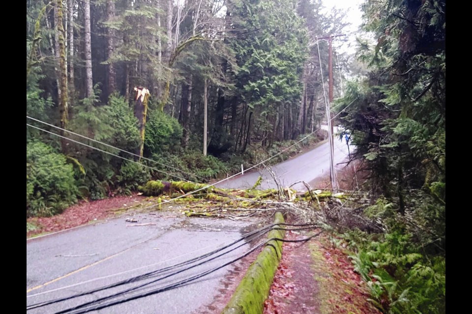
In East Sooke, hundreds were without power for most of Saturday after a fallen tree knocked out power in the area.
The outage affecting 788 customers was reported to B.C. Hydro just before 6:30 a.m.
Emcon Services Inc., the company that maintains roads in the area, warned people to stay away from downed wires.
Close to 2,000 in Campbell River were briefly without power on Saturday morning, though affected resident Cheynan Maynard said the outage was unrelated to the storms and was caused by a power pole in the 300-block of the Island Highway in Campbell River catching on fire.
— with files from The Canadian Press


