Update: After an overnight pause, more snow is expected beginning Monday afternoon in Greater Victoria. Environment Canada said 10 to 15 centimetres is expected, with more in some parts of the Island. The snow that began around 4 p.m. on Sunday is expected to contiinue until early Monday in Greater Victoria. The skies will then be cloudy or overcast until the afternoon. Snow will start to fall again as early as noon. Temperatures should range from -4 C in the morning to 0 C for the rest of the day.
The weather system bringing the snow is forecast to stall for about 12 hours over much of Vancouver Island. Snow is in the forecast for the Island beginning in the afternoon from Port Hardy south. It should reach the Lower Mainland by evening.
For Sunday, Victoria International Airport reported 16 centimetres of snow, Environment Canada said. Snow amounts around Greater Victoria varied widely. Some areas of Saanich, for example, received five to 10 centimetres.
= = =
Heavy snow and limited visibility prompted officials to close the Malahat Drive between Langford and Mill Bay Sunday evening; the highway reopened around 7:30 p.m. after plows had a chance to clear the snow.
The Pat Bay Highway from Swartz Bay to Keating Cross Road was also closed for several hours in the late afternoon and evening because of unsafe conditions due to the snowy weather. The Pat Bay reopened around 8:30 p.m. after it was plowed and conditions improved. But Sidney RCMP warned it was still very slippery.
The Malahat highway was closed at about 5:15 after snow started to fall in the afternoon. Officials throughout the south Island called on residents to stay off roads unless they had to travel as road conditions were treacherous.
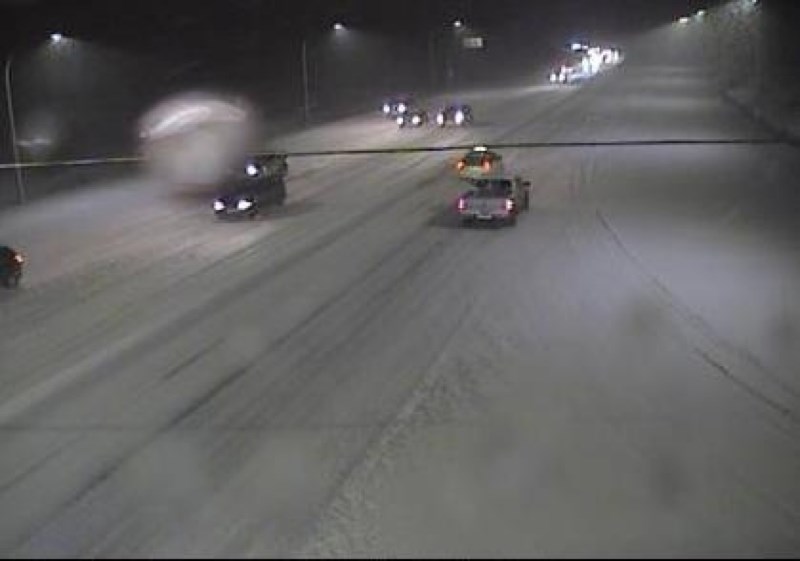
Because buses and cabs were unable to get to Swartz Bay for several hours, hundreds of foot passengers were briefly stranded at the ferry terminal. Webcams at the terminal and along the Pat Bay Highway showed near whiteout conditions.
Saanich police, saying they were responding to numerous collisions, appealed to motorists to stay off the roads. Sidney RCMP reported at least a dozen collisions.
The Sidney Volunteer Fire Department said it was called to help at the scene of a four-vehicle crash Sunday afternoon northbound on the Pat Bay Highway between Beacon Avenue and McDonald Park Road.
B.C. Ferries said its sailings were delayed because of slowed loading and unloading, and reduced visibility due to heavy fog and snow. For example, Coastal Celebration sailing from Tsawwassen to Swartz Bay was scheduled to leave at 9 p.m., but its actual departure was at 10:10 p.m., with expected arrival at 11:45 p.m.
B.C. Transit reported numerous delays on its routes, and some areas with hills are not being served. Routes 70, 72 and 75 on Sunday evening did not go beyond Royal Oak Exchange for several hours because northbound Pat Bay was closed.
In the Nanaimo area, snow started falling around midday Sunday and by early evening some 10 centimetres had already fallen. So much snow fell that some flights were cancelled at Nanaimo Airport.
Environment Canada issued snowfall warnings for East Vancouver Island from Duncan to Nanaimo and for the Malahat Highway from Goldstream to Mill Bay.
By mid-afternoon, snow was falling throughout South Vancouver Island, including Victoria and Nanaimo, Port Alberni and Qualicum Beach.
Sunday’s second blast of winter came just as B.C. Hydro was reporting crews had made good progress by Sunday in restoring power to thousands of homes in Greater Victoria that had lost power in Saturday’s storm.
High winds bringing trees down on power lines saw the lights go out for about 30,000 south Island and southern Gulf Island customers Saturday.
Crews working around the clock pared that number to about 5,300 by noon Sunday.
Many, primarily in Metchosin and on the west coast of the Island from Sooke through Port Renfrew and Jordan River, were still in the dark Sunday.
“Victoria and the Gulf Islands were hit hard. We’re down to the last few calls on the Gulf Islands and we have a few calls in the Victoria area, but the real work for us has been and is the West Coast,” said Ted Olynyk, B.C. Hydro spokesman.
“In Port Renfrew, Sooke and Jordan River, we’re bringing stuff on but access has been a real problem for us,” he said, as downed trees are blocking roads.
“The road was cleared this morning at about 2:30 out to Port Renfrew but we won’t have everybody up out in some of the more remote areas of the West Coast [today],” Olynyk said.
“Certainly we’re working through the night and our goal is to have everybody up as soon as we can because we’re very conscious of the temperatures and the next weather system that’s approaching.”
While clear early Sunday morning, clouds had moved in by noon and Environment Canada was predicting up to five centimetres of snow could accumulate in some areas.
Temperatures in the capital region were expected to reach zero, but strong winds beginning in the afternoon were expected to make that feel like -7.
Snow was predicted to end near midnight. The overnight low was expected to be -4 (with the wind chill near -13) in the CRD.
Highway 14 to Jordan River remained closed Sunday due to fallen trees.


