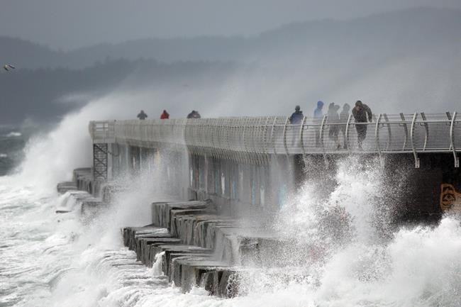
Update: Vancouver Island can expect very windy conditions and rain from Sunday morning to Monday afternoon, Environment Canada says in a special weather statement. The areas affected include Greater Victoria, Metro Vancouver, eastern Vancouver Island, western Vancouver Island, northern Vancouver Island, Sunshine Coast, southern sections of Howe Sound, and Southern Gulf Islands.
A weather system will approach western Vancouver Island on Sunday morning, bringing rain, 70 to 90 km/h southeast winds with gusts of 100 km/h and higher. The storm will reach eastern Vancouver Island by Sunday afternoon with winds of 50 to 70 km/h. Stormy conditions will persist into Sunday night and Monday morning.
Forecasters have "moderate confidence" that the winds will be strongest in western and northern Vancouver Island. Weather warnings will be issued once the track and intensity of the storm becomes clearer.
- - -
Get ready for wet and stormy weather as the first large low-pressure weather system of the season gathers strength in the north Pacific Ocean, bringing rain and a warning of strong southeast winds today on the west coast of Vancouver Island that could cause damage.
Some have called the weather system a weather bomb or bomb cyclone — a name given to a rapidly deepening low-pressure system where pressure decreases by 24 millibars or more in 24 hours. As the pressure drops, the vacuum created in the eye of the system draws in air, creating high winds.
Environment and Climate Change Canada won’t go that far, however.
“We are just referring to this as the first big low-pressure system of the season,” said Terri Lang, a meteorologist with Environment and Climate Change Canada. “This is the introduction of the storm cycle, the first of a number of storms commonly seen in the fall.”
The system, which has formed in the warm waters of the Pacific, is hundreds of kilometres west of Haida Gwaii and heading north. As it moves farther from land, the bands of moist air in its wake will result in heavy rain for the west coast of Vancouver Island and Haida Gwaii. Southern Vancouver Island will likely be spared.
“Just like last week with the atmospheric river weather system, Victoria will be spared the worst of this system because it is sheltered by the Olympic mountain range to the south and the spine of mountains that run north to south on Vancouver Island,” said Lang.
As conditions worsen, the west coast of Vancouver Island and Central Coast can expect to experience steady southeast winds of around 80 kilometres an hour, with gusts of up to 100 km/h in exposed coastal sections.
“Remember to clean your gutters and get your house in order, as the forecast is for storms one after another this week and next,” Lang said.


