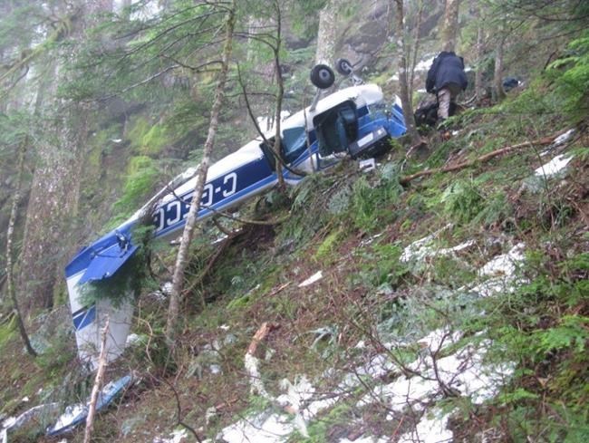
A Transportation Safety Board report into the fatal crash of a small plane near Tofino on Dec. 21 mentions weather issues, but does not say they were the cause of the crash.
The report said the Cessna 172H was flying in an area where cloud, icing and conditions that required flying by instruments — rather than visual flight rules — were forecast.
“While the investigation could not determine if any of these affected the [flight], it is important that pilots assess all available weather information before departure, plan alternate routes and operate within the limitations of their aircraft and privileges of their licences or permits,” the report said.
The TSB report did not pinpoint what caused the crash. It said the aircraft had enough fuel and had been maintained and passed its annual inspection.
The wreckage of the aircraft was found on a steep, densely wooded mountainside 57 kilometres from Tofino/Long Beach Airport.
Only a few treetops and limbs in the area were broken, the report said. “The average height of the trees at the occurrence site was approximately 150 feet and those nearest the aircraft had scarring on the lower 60 feet.”
The pilot and lone occupant, Heinz (Hal) Schulz, had been scheduled to land about 1:30 p.m. at the Courtenay Airpark. When he did not return, several Vancouver Island airports were checked, and Comox Valley RCMP called. Police then contacted the Victoria Joint Rescue Co-ordination Centre, which began searching about 4:30 p.m.
A search-and-rescue ground crew reached the crash site near Sydney Inlet Provincial Park about 9 a.m. Dec. 22.
The TSB report said damage to the propeller indicated it had been turning and the engine was producing power at impact.
“However, precisely how much power was being produced could not be determined,” the report said.
“During the engine examination, nothing was observed that would have prevented the engine from producing power.”
The flight was being taken for the United States’ National Oceanic and Atmospheric Administration, its goal being to collect air at specified altitudes, a process usually done at 17,500 feet and below.
Schulz had a contract with the NOAA and had been taking such flights in the area about every 12 days since 2002. The samples he collected were among others gathered by pilots from around North America for use by the Global Greenhouse Gas Reference Network.
A global-positioning system that came with the NOAA equipment showed where the crash site was.


